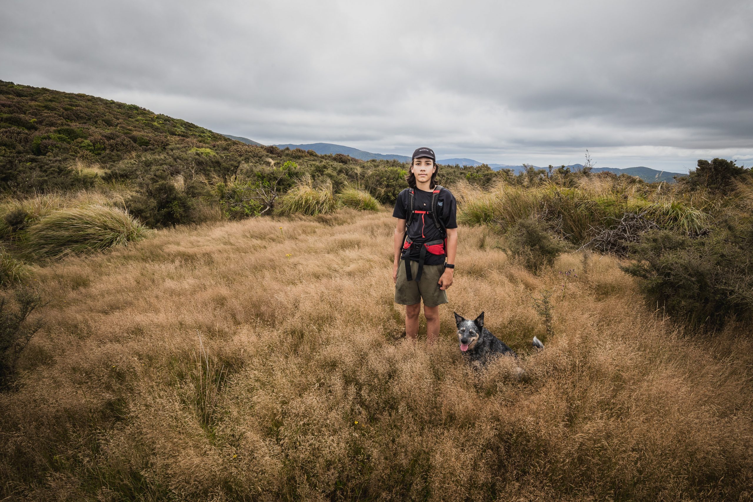
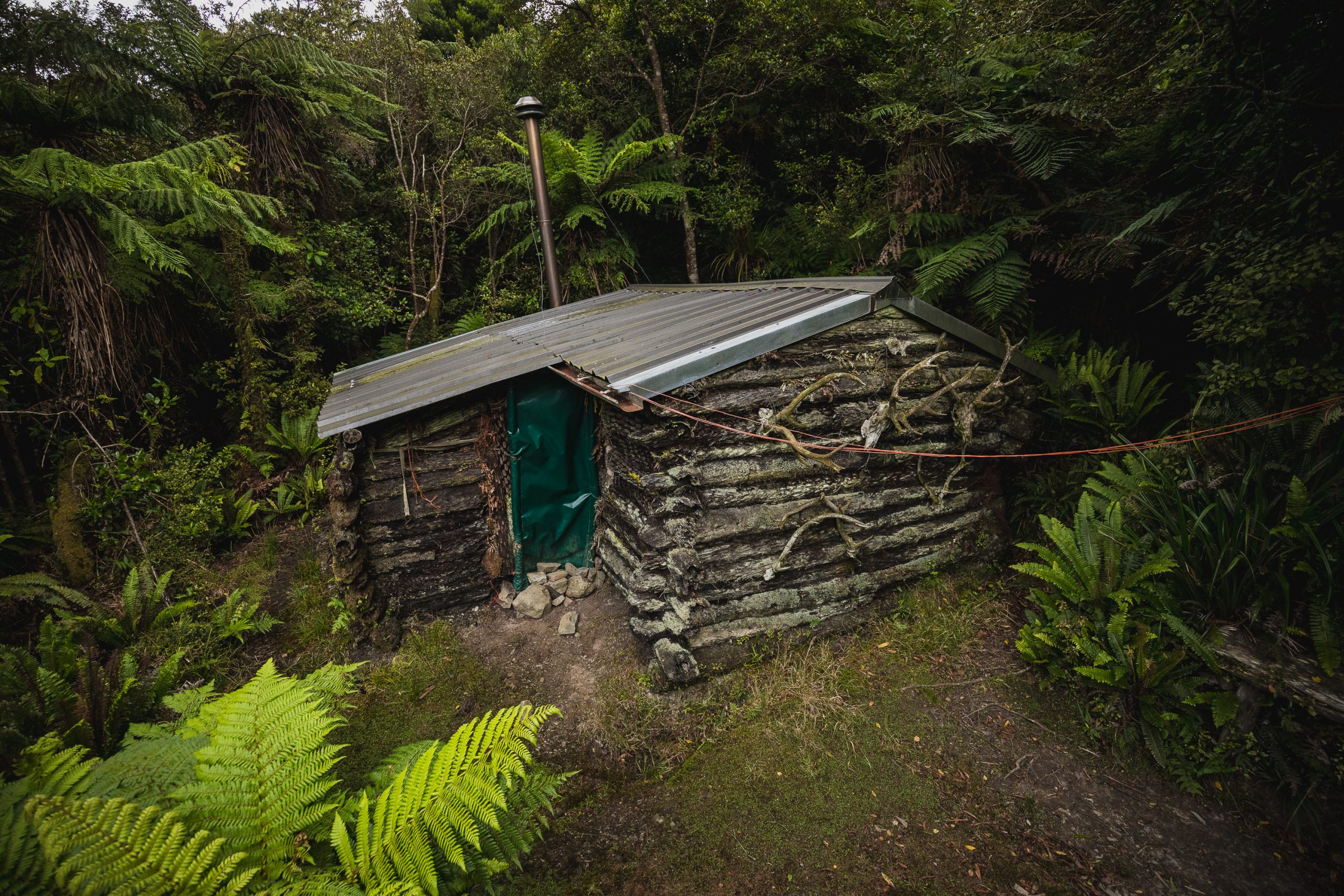
I’ve wanted to visit Punga Hut (or Miro Valley Hut as it’s also known) for a while now. The hut is built like a log cabin, but out of Punga, and sits at the northern end of the Tararua Range. Built by a local hunter in the late 50’s it’s still in use as a hunting base, it’s also very popular with hut-bagging day trippers. Punga Hut also happens to be the launching point for many a hut bagger’s mission to get to North Mangahao Bivvy, the northernmost hut in the Tararua. Technically there is no formed track to North Mangahao and trip reports vary in times from Punga to the bivvy, the quickest being 1.5 hours and some taking 4 hours (one way). I had planned this walk for Max and I, but when I went to wake him at 5:30am he was most definitely not feeling it. I let him sleep into 8:30 am and after breakfast, we were on the road to Shannon.
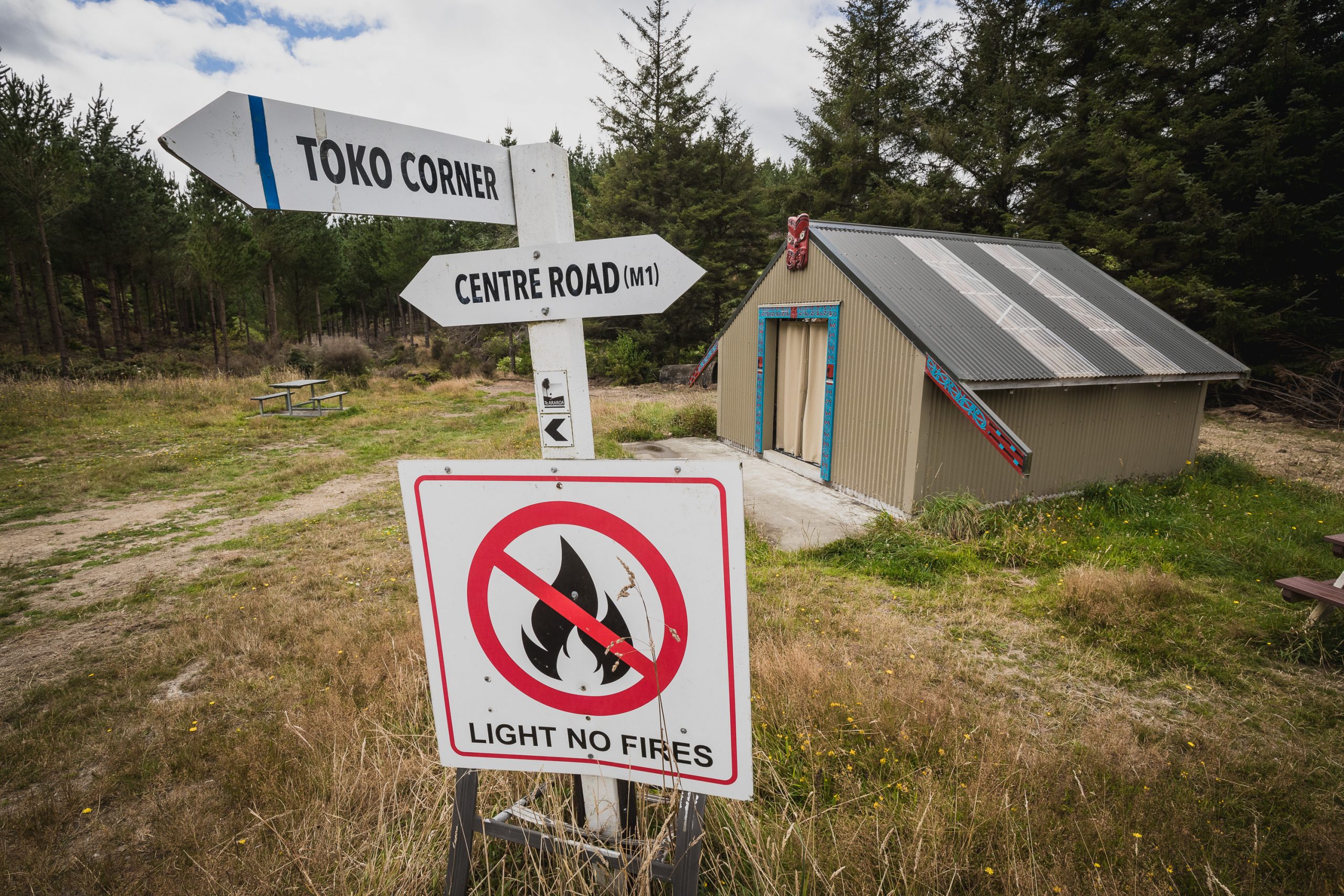
Now I’ll circle back on this later but there are lots of trip reports out there that describe getting to the start of the trail to Punga Hut. Some are complicated, describing every turn and intersection, but it’s so much more simple than all the trip reports seem to make it. Drive to Scott’s road, and take a right at the sign pointing to to the Te Araroa Trail. Once you have parked near the massive Gordon Kear Forestry gate you cross a stile and start walking on Center Rd (M1). Now here’s the simple bit, although you will walk through a few intersections, just stay on Center Rd (M1), the only turn you will take is when you take a right onto Scrub Ridge Rd (off Center Rd). That’s it, it’s that simple.
But that’s not how it happened for us. I grabbed a map from the Trippy Trampers 2016 blog post. DON’T DO THIS. While his map does show the most direct route to the park boundary and the start of the proper track to Punga Hut, the final 800m of this “road” is a bush lawyer overgrown nightmare. Max and I had been making fantastic time, and it looked like were going to make the edge of the forest in about an hour from the car. Until the track disappeared. The bush lawyer, tearing at our clothes and skin, became impenetrable, and navigating up this track started to slow us down. This 800m section of bush took an hour to push through. Many swearwords were uttered and Max may have said he was never tramping with me again, ever.
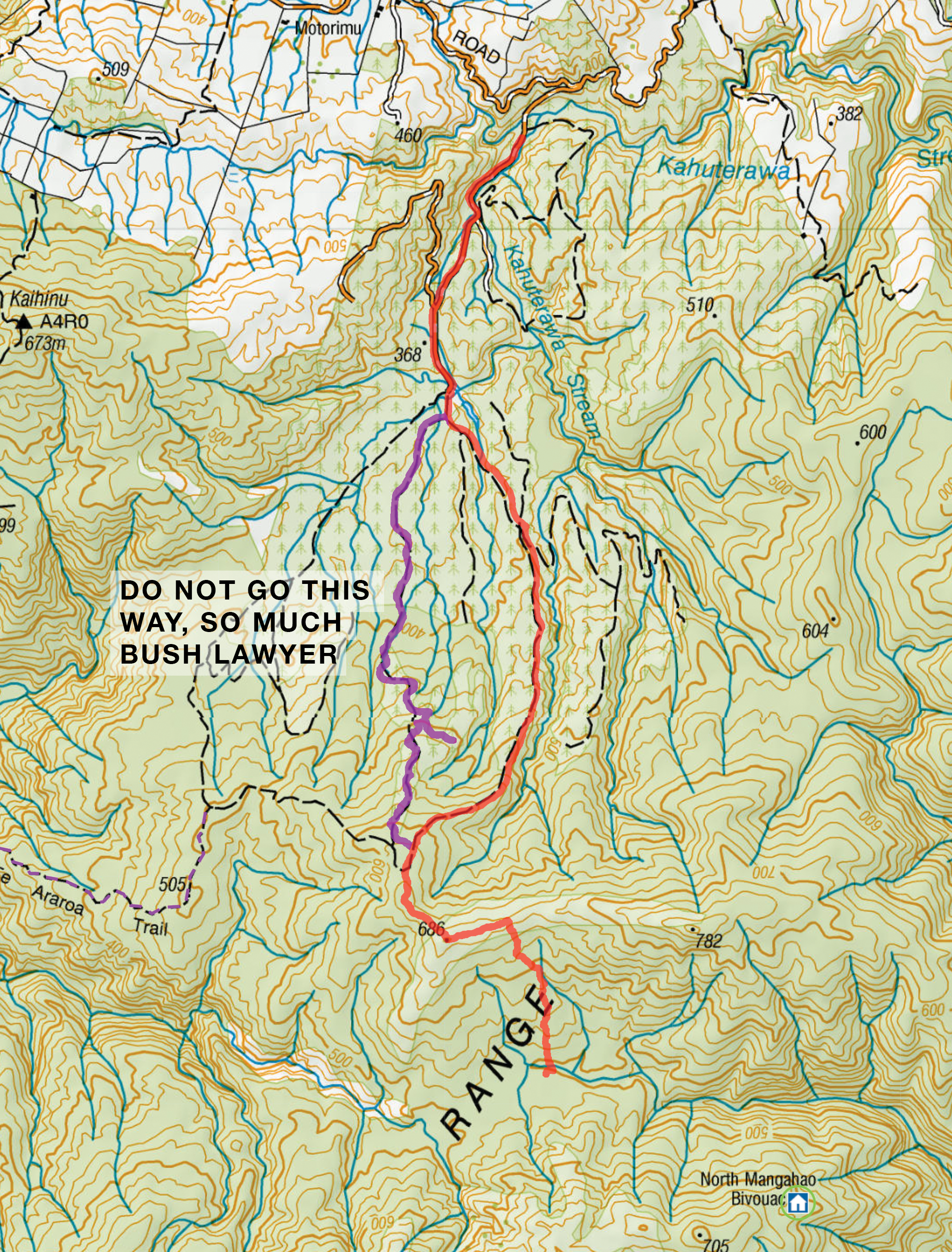
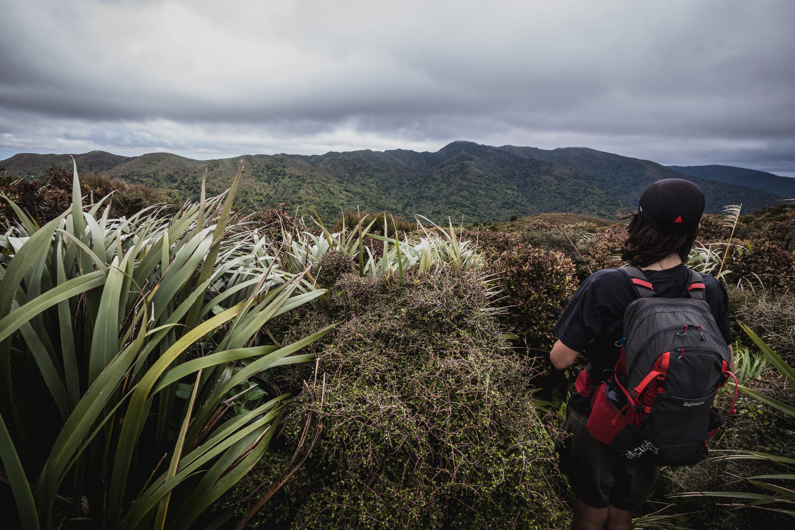
We eventually broke free and saw the track we should have taken, Scrub Ridge Rd, which while still a little overgrown, looked like a regularly walked track. From here the single track started and we hopped a fence and followed the well-trodden path east along the ridge toward and past •686. Several large “rocks” on the track signify the start of the descent to Miro Valley and Punga Hut.
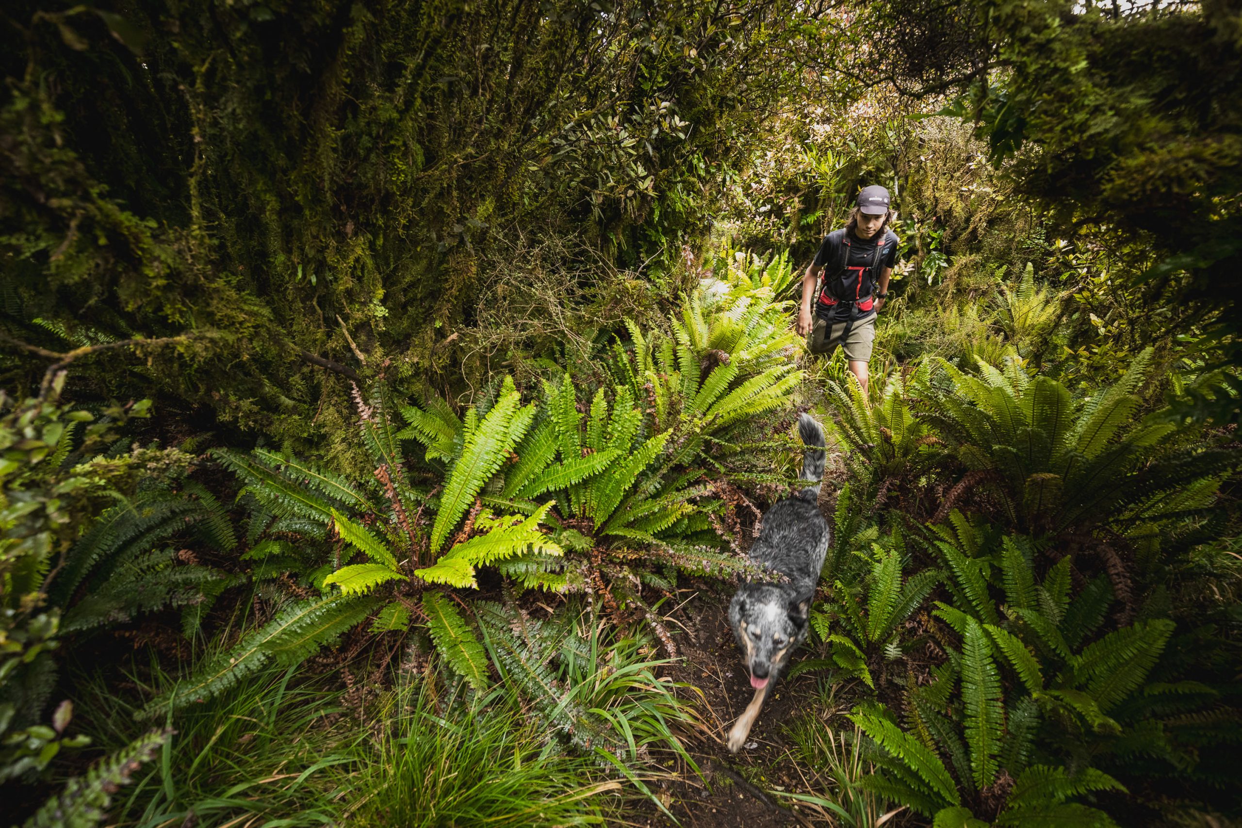
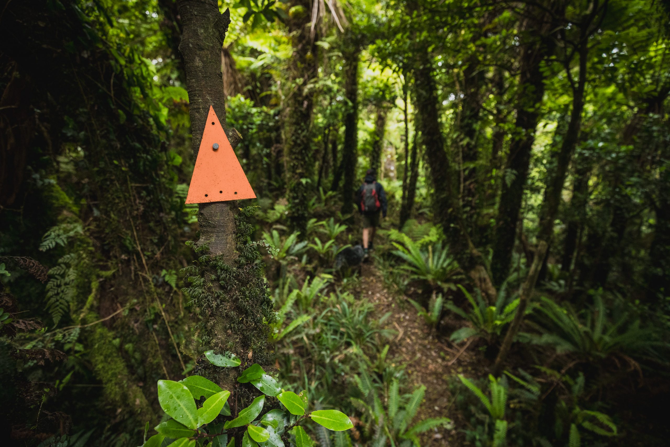
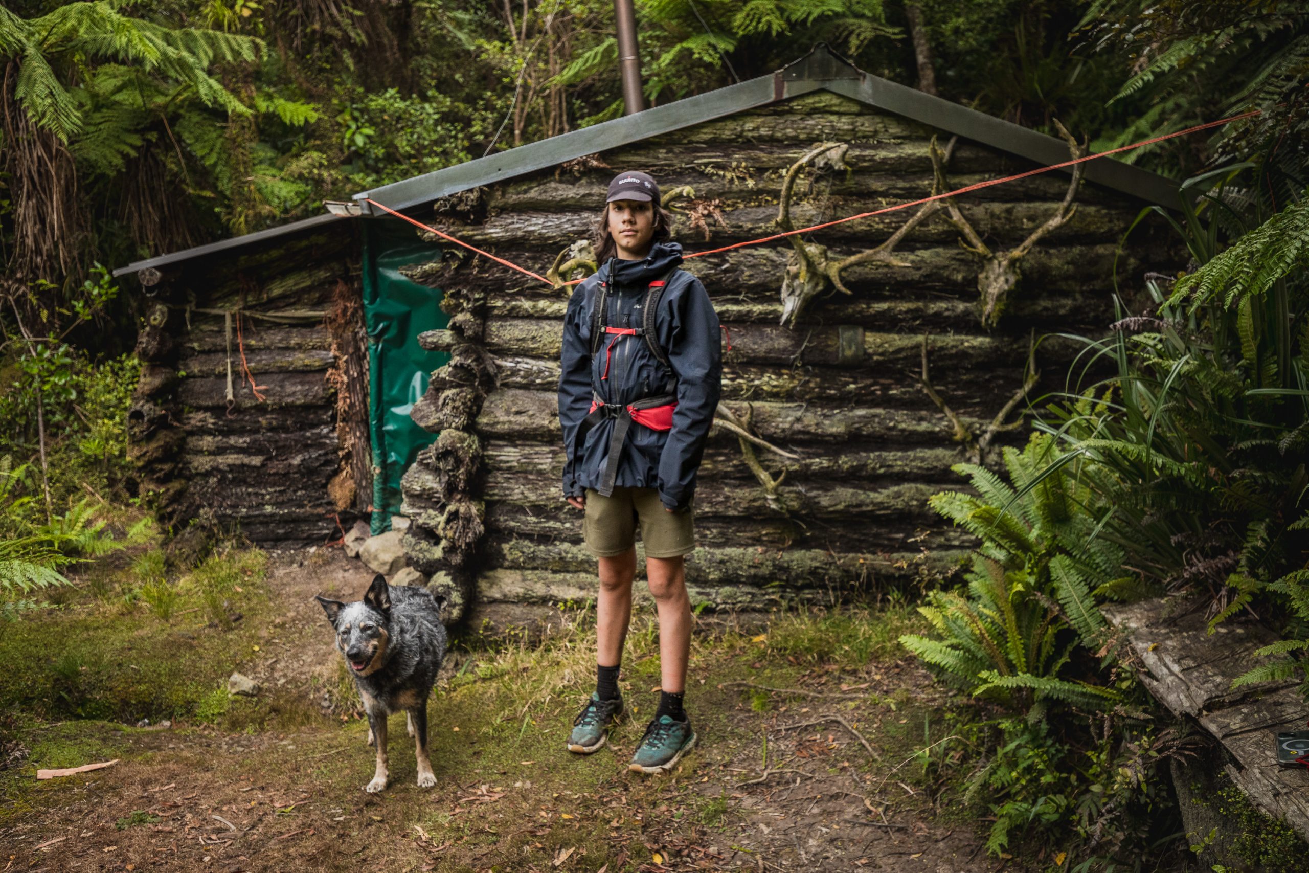
I do not know how recent they are, but this track is now marked with orange DOC triangles and is pretty much impossible to lose. 15 minutes after leaving the ridge we were crossing two creeks, a minute after that we were standing in front of possibly the coolest little hut in the whole range. Max was ecstatic, and almost forgave me for the hole in his brand new birthday top.
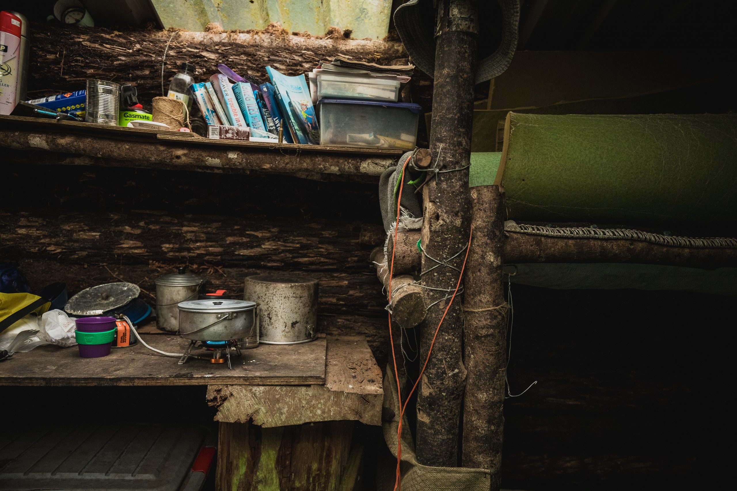
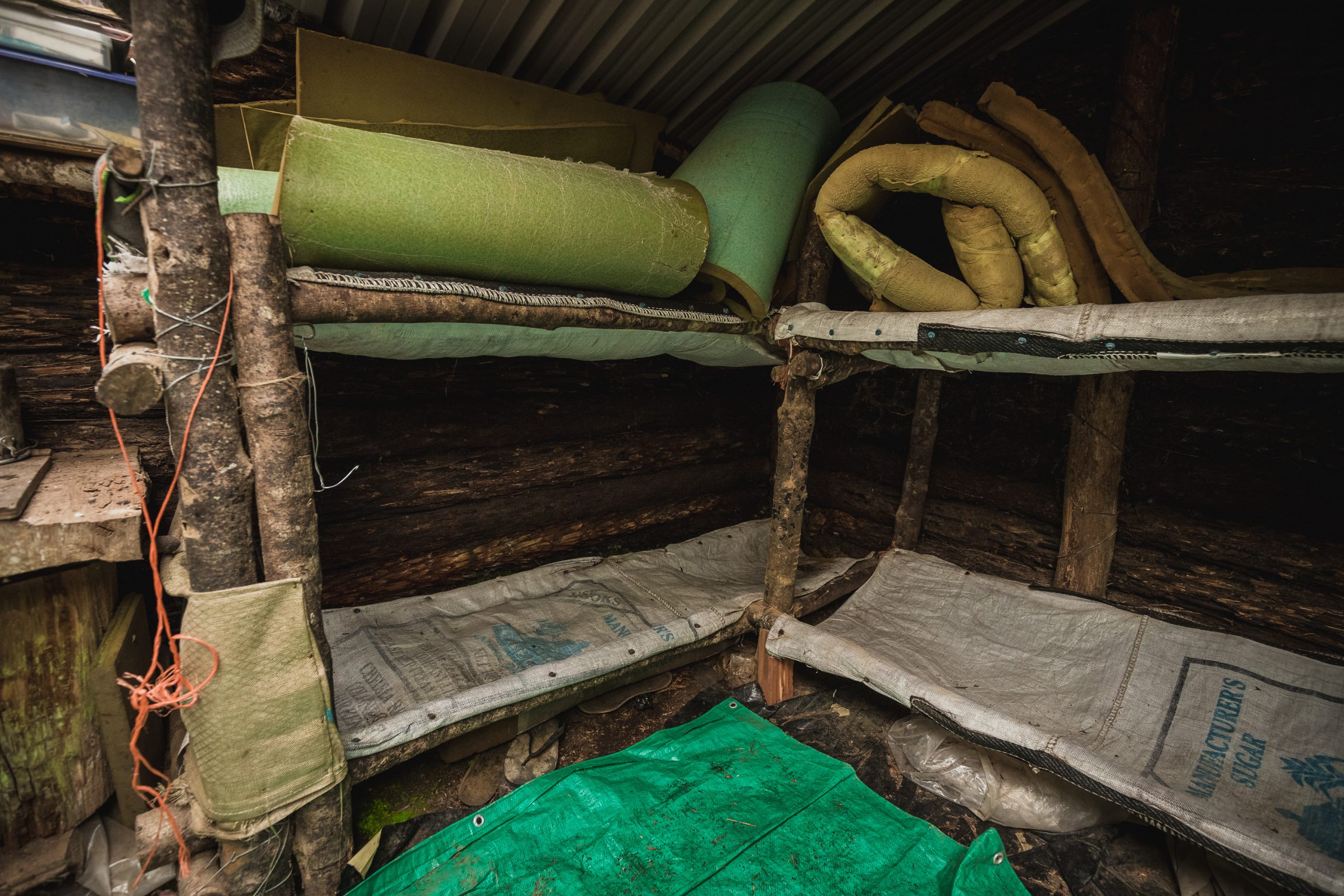
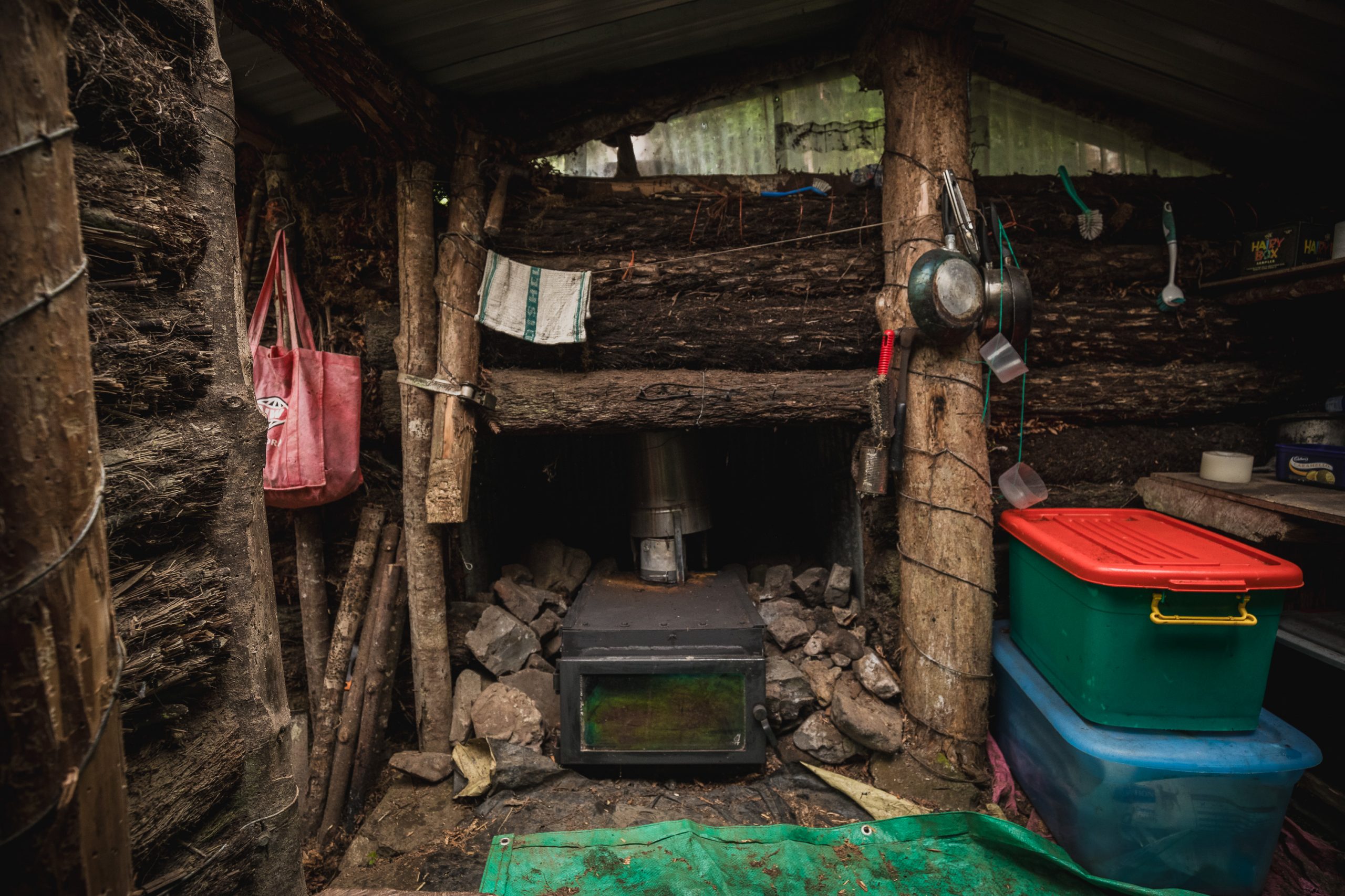
We popped inside out of the wind, cooked up lunch, ate a few home-baked chocolate cookies, and read a few hut book entries. Max thought he’d chop a little wood while I tidied up and snapped a few photos of the interior. The hut is well looked after and really light and airy, a sweet Masport fireplace looks like it would keep things warm in the winter and the beds looked pretty comfy. After a leisurely break, we popped our packs on and began our tramp back to the car.
With Max leading, we made short work of the climb back to the boulders and along the ridge. We took Scrub Ridge Rd, joined Center Rd and we were back at the car in under two hours, both excited about coming back with more time up our sleeves, and shittier clothes to find North Mangahao Bivvy.